


Imagine you want to find out what a rock is made of without having to break it. That's exactly what X-ray fluorescence spectrometry (XRF) allows us to do. It is one of the most widely used and effective techniques for elemental analysis of rocks, used both directly in the field with handheld devices and in our state-of-the-art laboratories.
But how does XRF work? It's simpler than it seems:
- X-ray irradiation: The spectrometer emits a powerful X-ray beam onto the rock sample.
- Electrons released: When these primary X-rays collide with atoms in the sample, they can "kick" electrons out of their inner orbits.
- Energy flash: The resulting "hole" in the electron shell is unstable. The atom tries to fill the hole immediately, so an electron from a higher energy orbit falls into it. This "fall" releases a flash of energy in the form of characteristic X-rays.
- Unique fingerprint: Each element—whether iron, silicon, or even uranium—emits X-rays with a completely unique energy (wavelength). It is like its specific "fingerprint."
- Reading the spectrum: The spectrometer detector captures this radiation and measures its energy and intensity. Based on these parameters, it then accurately determines which elements are present in the sample (qualitative analysis) and in what quantities (quantitative analysis).
The advantages of XRF are crucial for geological research. It is a non-destructive method, meaning that the sample remains intact during measurement. It provides quick results and often does not require complex sample preparation. In addition, it can detect a wide range of elements, from magnesium to uranium. The disadvantage may be a higher error rate (in the order of tenths of a percent) when compared to laboratory spectrometers.
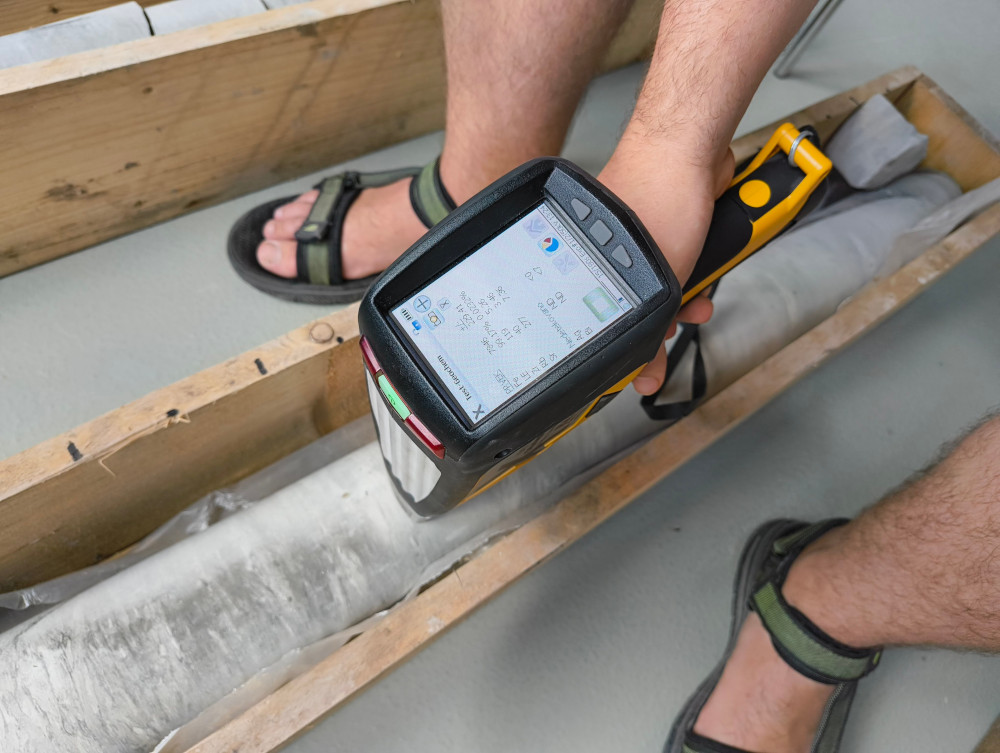
At RINGEN, we use a spectrometric method to determine the elemental composition of sedimentary rocks. By measuring so-called proxy parameters, such as the silicon-to-aluminum ratio (Si/Al), we can determine changes in the grain size of sedimentary rocks. This analysis refines the existing lithological description of rocks to a level that is not visible at first glance and allows us to recognize changes in sediment input. These changes may be caused, for example, by the rise or fall of the sea level at the time, which was often influenced by ancient climate cycles. The potassium-to-aluminum ratio (K/Al) helps quantify the intensity of rock weathering in source areas and its changes over time, which are mostly directly linked to the development of climatic conditions (total precipitation and the nature of its seasonal distribution, temperature etc.).
Milanković cycles: Cosmic dance influencing Earth's climate
Sometimes, climate change is not only caused by events on Earth, but also by the universe. This is where Serbian geophysicist Milutin Milanković (1879–1958) and his Milanković cycles come into play. These are long-term, cyclical changes in the Earth's orbit around the Sun that affect the distribution of solar radiation reaching the Earth and exceed annual fluctuations. These cycles have fundamentally influenced the formation of ice ages and interglacial periods during the Quaternary. Milanković identified three basic cycles that are taken into account when determining these climate changes:
- Precession: This is the orientation of the Earth's axis, which slowly wobbles like a spinning top. The cycle lasts approximately 25,800 years.
- Eccentricity: This defines the shape of the Earth's orbit around the Sun. It is not perfectly circular, but elliptical, and its "eccentricity" changes over tens of thousands of years. The cycles last approximately 100,000 and 405,000 years.
- Obliquity: This defines the tilt of the Earth's axis relative to the plane of its orbit. This tilt changes in cycles lasting approximately 40,000 years.
Milanković's basic idea was that astronomically induced variability in solar radiation had a fundamental influence on the growth and melting of large ice sheets. His theory thus provided the first generally accepted model for understanding the causes of Pleistocene glaciation. Today, spectrometry allows us to examine the chemical composition of sediments and thus track these ancient climate cycles in the rock record.
Stories from the depths of Litoměřice: Cretaceous, Carboniferous, and Permian
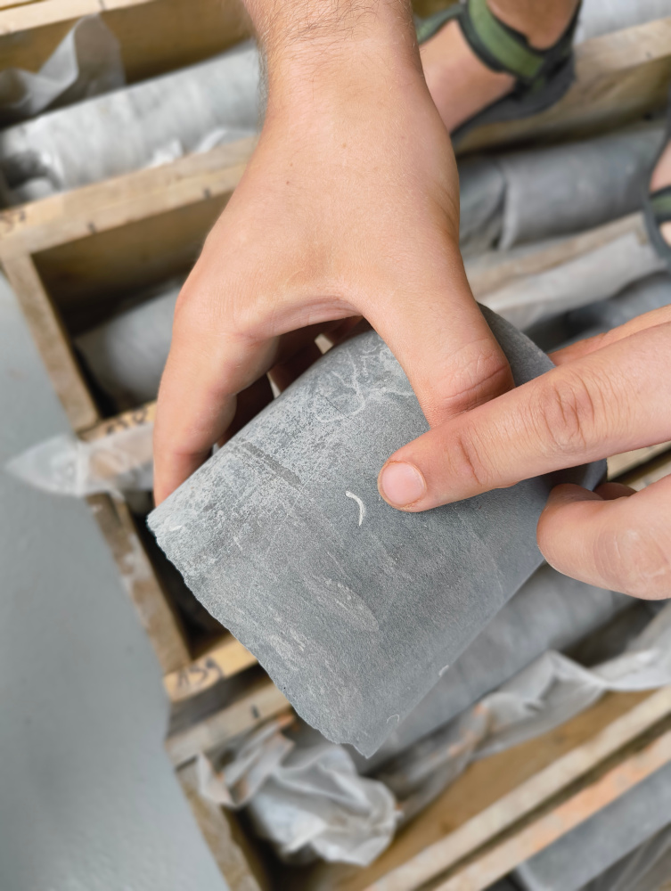
At RINGEN geological periods are studied using core samples obtained from a new 516-meter-deep borehole, which was completed in the spring of 2025. Sedimentologist Jan Bohadlo is primarily investigating the Mesozoic period of the Upper Cretaceous. These layers are found at depths of up to 180 meters in the Litoměřice area. The rate of sedimentation varied during the Cretaceous period in the Litoměřice region. In the event of a significant slowdown in sedimentation, which could last tens to hundreds of thousands of years, glauconite – a green mineral precipitating from seawater – forms on the sea floor, which serves as a very good indicator of such a slowdown.
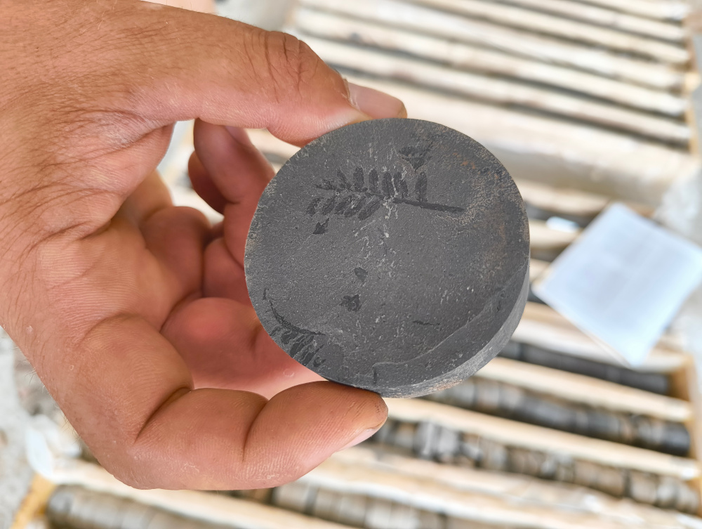
Fine-grained sediments are rich in fossils. We find abundant shells of bivalves (e.g., Pecten sp., Rhynchostreon sp.) and serpulid worms, which are animals that lived in the “tunnels” on the sea floor, either alone or in colonies. The occurrence of various fossils can be an indicator of ancient climate change – for example, the species of serpulid worms Pyrgopolon sp. indicates cooling in the Upper Cenomanian. The original sea that covered the Czech Cretaceous Basin was warm and connected to the Tethys Ocean. This Ocean was located approximately in the area of today's Mediterranean Sea – at that time, the Alps and Carpathians were just forming. However, serpulid worms of the genus Pyrgopolon originate from the colder Boreal sea located to the north, approximately in the area of today's Baltic Sea and Germany. The presence of this fossil in our sediments indicates that during the Cenomanian the shallow sea located in the area of Czechia was connected to cold Boreal sea in the area of the Elbe Strait, which allowed the cold water to incoursion our territory. In addition to fossilized animal bodies, we also find so-called ichnofossils – fossilized traces of activity of organisms, such as branched Chondrites isp. Their large accumulation in the core can be further evidence of slowed sedimentation.
Beneath the Cretaceous sediments lie much older deposits from the Carboniferous and Permian periods, which were deposited in the continental environment of rivers, floodplains, lakes, and coal-forming swamps of the Kladno-Rakovnik Basin. These are the focus of sedimentologist Richard Lojka, another of our researchers, who studies the Paleozoic Carboniferous and Permian strata. A new deep borehole in Litoměřice, located on the northern edge of the basin, has encountered sediments from the two youngest units of the basin fill – the Líně and Slaný formations.
The Carboniferous period (350–300 million years ago) was a time of amphibians, impenetrable forests, vast swamps, and a humid tropical climate. After the initial phase of filling the basin with sediments from river flows and floodplains with carbon-forming swamps, the entire forest basin was flooded for a relatively short period (100 to 500 thousand years) by a vast freshwater lake covering an area of 10,000 km² and reaching depths of up to 100 meters, stretching from Plzeň to Trutnov. Its existence is evidenced by a 20-meter thick layer of dark grey to grey mudstones of the Mšec Member in the lower part of the Slaný Formation. This interval, very rich in organic matter (5-10%), represents an unique, high resolution record of continuous sedimentation, which provides a wealth of information about the development of the environment and climate in the Carboniferous period. Analysis of fossil pollen and spore assemblages has made it possible to reconstruct the development and dynamics of plant communities from the wider vicinity of the lake, while the composition of small organic matter residues has helped to identify short episodes of drought accompanied by forest fires. White layers of volcanic ash containing zircon provided valuable and high precision data on the age of this unit. The lake was gradually filled with sediments and replaced by extensive floodplains and shallow lakes, where the decline in the mean annual precipitation and increase in precipitation seasonality in the youngest Carboniferous period gradually began to be manifested by redding of deposits and occurrence of carbonate nodules.
The Permian period (299–252 million years ago) was characterized by the drying up and decay of carbon-forming forests, which accelerated the evolution of reptiles even before the beginning of the dinosaur era in the Mesozoic. During this period, volcanic mountain ranges were located on the edges of the basin. Evidence of this can be found in a geological formation called the Teplice-Altenberg Caldera. This is actually a collapsed volcano, which left indelible traces in the bedrock in the form of vein bodies and supply channels. Volcanic activity produced zircon minerals, which contain radioactive elements, especially uranium. Thanks to the known half-life of these elements, we can date layers of volcanic ash back to millions of years of Earth’s history with amazing accuracy reaching 200,000 years. Zircon is a very resistant mineral, which is why it is often recycled in magmatic chambers and can even tell us about several geological epochs. When exposed to high pressures and temperatures, it does not melt; on the contrary, another, younger layer forms on its surface. Zircons are no exception, with 2 billion-year-old material at their core and significantly younger zones towards the edges.
From core exploration to practical applications: the SYNERGYS project
"In order to obtain information about individual geological units, specifically the Bohemian Cretaceous Basin, we often compare data from several boreholes. In most cases, we do not have access to the cores from these boreholes, but only to logging data (records of the geophysical characteristics of rocks). Spectrometric analysis of the core newly obtained in Litoměřice allows us to better understand this logging data, even from boreholes tens of kilometers away," explains Jan Bohadlo.
Within the SYNERGYS project, for example, spectrometry helps determine why some parts of the pilot borehole in Litoměřice have high porosity, which causes loss of mud and cementation, thereby increasing drilling costs. It also helps us identify the layers that are most suitable for heat storage. For example, the so-called insulator layer at the bottom of the Turonian sequence is important. It is a rock that does not allow water to pass through and thus borders the Cenomanian aquifer from above. At much greater depths, beneath the clay layer of lake sediments of the Mšec layers, which is a significant regional insulator, there is groundwater of Carboniferous age.
Conclusion
The RINGEN research center is at the forefront of geological exploration, thanks in part to advanced spectrometric methods. It reveals not only the chemical composition of rocks, but also the ancient climatic cycles that shaped our planet. Research into the local geological subsoil contributes to our understanding of Earth processes and has concrete implications for practical projects such as heat storage within the SYNERGYS project. In this way, we not only expand our scientific knowledge, but also contribute to the sustainable use of underground resources for future generations.

