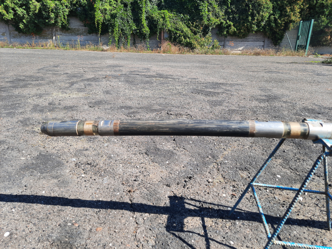
[3.9.2024] During August 2024, a geophysical measurement was carried out in one of the boreholes at the RINGEN Research Centre. The borehole LT2, in which the measurements were made, is 190 metres deep and, due to its shallow depth, only penetrates sedimentary layers, which are mainly sandstones and siltstones.
"The geophysical measurement allows us to determine whether the casing (in this case a steel pipe inserted as a reinforcement in the borehole) is tightly adhering to the rock by means of cementation. If there were cavities, future temperature measurements with an optical cable would not be accurate. The leak check is carried out using ultrasonic signals. In places where the casing is firmly adhered to the rock, the signal is weak. Where there are cavities between the casing and the rock, the casing 'resonates' and the signal is stronger, indicating their presence." explains geologist Lucie Janků from the Faculty of Science at Charles University. The acoustic probe for measuring the tightness between the casing and the rock looks like this:

In addition to the presence of cavities, other parameters are measured using an ultrasound probe. So what exactly is measured and why?
Verticality
A series of boreholes just a few metres apart will be used for heat accumulation. Maintaining a vertical orientation is therefore very important, otherwise the boreholes would not have a uniform space (spacing) between them and the heat would be spread and stored unevenly in the storage. In the worst case, the individual boreholes would intersect and be destroyed during drilling.
To measure verticality, a so-called inclinometer is used, which also measures the degree of deviation and the azimuth, i.e. the direction of deviation. The borehole should ideally be completely vertical. This is achieved both by a suitably selected drilling technology and by careful, unhurried work. If a mistake is made and the borehole is not perpendicular, the verticality can be corrected with directional drilling heads. However, only a few companies have these and their work is expensive. So patience not only brings roses, but in this case a nicely perpendicular borehole and less cost associated with it.
Natural radioactivity
This is not strong radioactivity, just the weak radiation emitted by, for example, the potassium isotope 40K, which is present in most rocks. Sandstones tend to have little of it, clays have a lot of it, so we can tell which rock is which by measuring the radioactivity without having to pull samples to the surface.
Other radiometric methods, which use an active emitter mounted directly on the probe, also measure the density and porosity of rocks using back-emitted gamma photons or neutrons, so that the result is not only information about the species but also about the properties of the rocks. The probe with the active emitter is shown in the photo below.

Optical and acoustic measurements
This type of probe cannot be used in our borehole because the signal is interfered by the steel casing. However, in other cases where the borehole is without reinforcement, this method is very effective. It shows the inside of the borehole realistically, so that even a layman is able to distinguish the boundaries of individual rock layers, the existence of cavities and cracks. Based on the data obtained, an effective 3D model of the borehole can be modelled in software.
Here is an example of a 3D model (left part of the picture), on the right is a 2D view (basically a 3D model "expanded" into a surface), obtained by acoustic method in another borehole.

Measurements using acoustic and radiometric methods take a very long time, unlike verticality measurements. The probes are lowered into the borehole at a speed of 1-2 m per minute. In boreholes several kilometers deep, then one measurement takes several days. In the case of the 190 m deep LT2 borehole, it took a full day to measure five methods. Once the measurement is complete, a downhole seismometer and a fibre-optic cable for temperature measurements will be installed in the borehole.
Groundwater temperature and flow
If the results of the carotation show that the casing is well sealed, a so-called thermal response test will be carried out in the borehole. The borehole is heated and then the rock temperature is measured over a given period using an optical cable permanently cemented to the inner surface of the casing. The thermal diffusivity of rocks, i.e. their ability to heat up or cool down over time, is known from laboratory measurements. If the rate at which the temperature settles does not match the measured thermal diffusivity, this indicates groundwater flow around the borehole.
"This is essential if we want to use the boreholes for heat storage, as is planned for the SYNERGYS project in Litoměřice. The water-saturated rock layers, where the water flows, will cool much faster and take the heat away. On a smaller scale, we can imagine the borehole as a heating coil that we want to use to heat water for tea. If we put it under a running tap (or layer of sediment where groundwater flows), the heated water will drain away immediately. So the goal is to place the boreholes where the groundwater does not flow (or place the heating coil in a kettle of standing water). Otherwise, the summer heat would "flow away" and there would not be much left by winter," explains geologist Lucie Janků from the Faculty of Science of Charles University.


